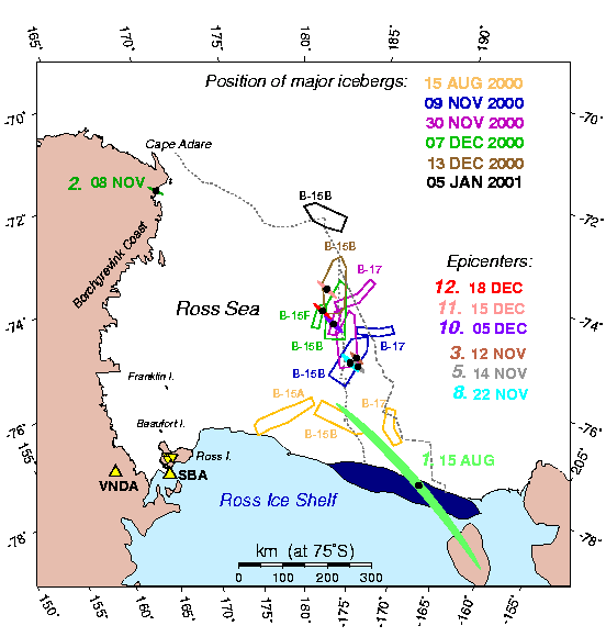
On this map, the individual black dots (with colored error ellipses) represent the
epicenters of the hydroacoustic signals detected in Polynesia at a number of dates
(see color key at right).
The open symbols indicate the position of mega-iceberg B15-B (and of the smaller
companion B17) as there were drifting through the Ross Sea during the last third
of the year 2000 (see color key at top). Note the excellent correlation between the
drift of the epicenters and of the bergs.
Return to Emile A. Okal's research page.